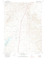
1968 Map of Melandco
USGS Topo · Published 1985About this map
Melandco sits at a critical junction in this high desert landscape, where the Union Pacific railroad tracks parallel the drainage of Willow Creek. The terrain is defined by the significant elevation of Windermere Hills to the east and Summer Camp Ridge to the west, creating a corridor for transportation and water management. A primary hydrological feature is the Bishop Creek Reservoir, which maintains a normal pool elevation of 5891 feet and collects runoff from Bishop Creek and Johnson Creek.
Find a feature on this map
22 named features on this map. Tap any name to fly to it.
Don’t see what you’re looking for? This feature index may not catch every label — zoom into the map to look around manually.
Map Details
Editions of this 1968 Melandco Map
2 editions found
Other maps of this area

1955 · Wells
USGS Topo · 1:250,000

1958 · Wells
USGS Topo · 1:250,000

1961 · Wells
USGS Topo · 1:250,000

1968 · Wilkins
USGS Topo · 1:24,000

1968 · Holborn
USGS Topo · 1:24,000

1968 · Melandco
USGS Topo · 1:24,000

1968 · Wells Peak
USGS Topo · 1:24,000

1968 · Summer Camp
USGS Topo · 1:24,000
1968 · Oxley Peak
USGS Topo · 1:24,000

1968 · Wine Cup Ranch
USGS Topo · 1:24,000