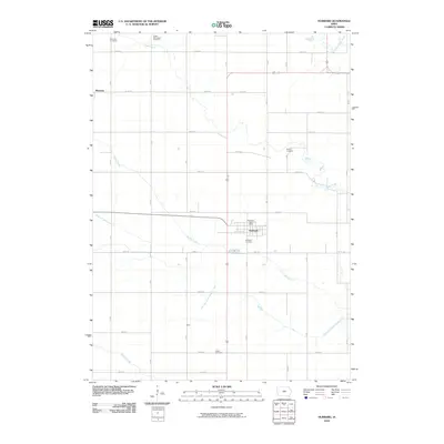
2010 Map of Hubbard
USGS Topo · Published 2010About this map
Hubbard stands as the primary hub of this Hardin County landscape, organized around its central grid and the Hubbard Post Office. The surrounding prairie is defined by a rigorous section-line road network, including 270th St and Co Rd S27, which connects the smaller settlements of Sherman and Idaho. This agricultural layout is punctuated by numerous burial grounds that speak to the area's pioneer heritage, such as the Tipton Norwegian Cemetery near the northern boundary and the Idaho Cemetery to the south.
Find a feature on this map
29 named features on this map. Tap any name to fly to it.
Don’t see what you’re looking for? This feature index may not catch every label — zoom into the map to look around manually.
Map Details
Editions of this 2010 Hubbard Map
This is the sole edition of this map. No revisions or reprints were ever made.
Other maps of this area

1954 · Waterloo
USGS Topo · 1:250,000

1955 · Waterloo
USGS Topo · 1:250,000

1975 · State Center NW
USGS Topo · 1:24,000

1975 · Zearing
USGS Topo · 1:24,000

1975 · Mc Callsburg
USGS Topo · 1:24,000

1979 · Buckeye West
USGS Topo · 1:24,000

1979 · Buckeye East
USGS Topo · 1:24,000

1979 · New Providence
USGS Topo · 1:24,000

1979 · Hubbard
USGS Topo · 1:24,000
1979 · Radcliffe
USGS Topo · 1:24,000