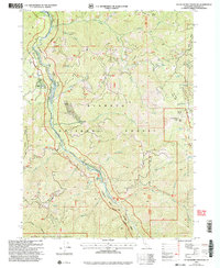
2001 Map of Huckleberry Mountain
USGS Topo · Published 2004About this map
The Klamath Wild and Scenic River corridor dominates this high-country landscape, flowing through the heart of the Klamath National Forest. At the turn of the 21st century, the area remained a dense network of hydrologic features and high ridges, including the prominent Huckleberry Mtn and Titus Pk. Local history is anchored by the Turner Mine Prospect in the north and the therapeutic waters of Sulphur Springs along the riverbanks.
Find a feature on this map
41 named features on this map. Tap any name to fly to it.
Don’t see what you’re looking for? This feature index may not catch every label — zoom into the map to look around manually.
Map Details
Editions of this 2001 Huckleberry Mountain Map
This is the sole edition of this map. No revisions or reprints were ever made.
Other maps of this area

1914 · Seiad
USGS Topo · 1:125,000

1922 · Seiad
USGS Topo · 1:125,000

1948 · Weed
USGS Topo · 1:250,000

1950 · Weed
USGS Topo · 1:250,000

1955 · Seiad Valley
USGS Topo · 1:62,500

1955 · Ukonom Lake
USGS Topo · 1:62,500

1955 · Scott Bar
USGS Topo · 1:62,500

1956 · Happy Camp
USGS Topo · 1:62,500

1958 · Weed
USGS Topo · 1:250,000

1963 · Weed
USGS Topo · 1:250,000