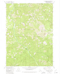
1980 Map of Huckleberry Mtn.
USGS Topo · Published 1980About this map
Elk Creek serves as the central drainage for this northern California landscape, which is largely defined by the high ridges of the Klamath National Forest. Along the western bank of the creek, the small settlement at Hoskin. sits near several water tanks, while a network of pack trails and jeep trails provides the only transit into the surrounding heights. The map records several mineral prospects in the northern reaches, including one near Copper Creek. To the south, the terrain transitions into the Marble Mountain Wilderness, where landmarks like Johnsons Hunting Grounds suggest the traditional recreational use of these mountains. The presence of Sulphur Springs and multiple other named springs like Buckhorn Spring indicates a landscape where water sources dictated the placement of camps and waypoints throughout the late twentieth century.
Find a feature on this map
43 named features on this map. Tap any name to fly to it.
Don’t see what you’re looking for? This feature index may not catch every label — zoom into the map to look around manually.
Map Details
Editions of this 1980 Huckleberry Mtn. Map
This is the sole edition of this map. No revisions or reprints were ever made.
Other maps of this area

1914 · Seiad
USGS Topo · 1:125,000

1922 · Seiad
USGS Topo · 1:125,000

1948 · Weed
USGS Topo · 1:250,000

1950 · Weed
USGS Topo · 1:250,000

1955 · Seiad Valley
USGS Topo · 1:62,500

1955 · Ukonom Lake
USGS Topo · 1:62,500

1955 · Scott Bar
USGS Topo · 1:62,500

1956 · Happy Camp
USGS Topo · 1:62,500

1958 · Weed
USGS Topo · 1:250,000

1963 · Weed
USGS Topo · 1:250,000