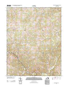
2013 Map of Huddleston
USGS Topo · Published 2013About this map
Goose Cr and its winding tributaries define this portion of Bedford County, where the Piedmont landscape meets the rising elevations of Turner Mountain and Dumpling Mountain. The settlement pattern centers on the crossroads of Huddleston and smaller communities such as Mentow and Gillespie, linked by a network of rural roads that follow the ridges and creek valleys. Evidence of the area's agricultural and local industrial past is visible at Preston Millpond and the various branches like Crab Orchard Cr and Buffalo Br that drain the terrain.
Find a feature on this map
88 named features on this map. Tap any name to fly to it.
Don’t see what you’re looking for? This feature index may not catch every label — zoom into the map to look around manually.
Map Details
Editions of this 2013 Huddleston Map
This is the sole edition of this map. No revisions or reprints were ever made.
Other maps of this area

1890 · Roanoke
USGS Topo · 1:125,000

1891 · Roanoke
USGS Topo · 1:125,000

1892 · Lynchburg
USGS Topo · 1:125,000

1947 · Roanoke
USGS Topo · 1:250,000

1950 · Goode
USGS Topo · 1:62,500

1950 · Peaks of Otter
USGS Topo · 1:62,500

1951 · Moneta
USGS Topo · 1:62,500

1951 · Altavista
USGS Topo · 1:62,500

1959 · Roanoke
USGS Topo · 1:250,000

1963 · Roanoke
USGS Topo · 1:250,000