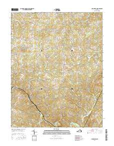
2016 Map of Huddleston
USGS Topo · Published 2016About this map
Huddleston serves as a central hub in this Virginia landscape, where the rural topography of Bedford County meets the Campbell Co line. The terrain is defined by a series of prominent rises including Turner Mtn, Dumpling Mtn, and Moon Mtn, which overlook a network of creek valleys. High-elevation hollows such as Peartree Hollow and Lonely Hollow reveal the intricate drainage patterns of Crab Orchard Cr and Goose Creek as they wind toward the regional river systems. Local history and genealogy are anchored by rural landmarks like the Leftwich Cem and Old Bethany Cem. Small crossroads communities such as Mentow, Gillespie, and Chestnut Fork are connected by a web of named secondary roads, while Preston Millpond suggests the area's agricultural and water-powered heritage. The map records a quiet, upland character defined by family-named landmarks and the persistent paths of historical farm-to-market routes.
Find a feature on this map
88 named features on this map. Tap any name to fly to it.
Don’t see what you’re looking for? This feature index may not catch every label — zoom into the map to look around manually.
Map Details
Editions of this 2016 Huddleston Map
This is the sole edition of this map. No revisions or reprints were ever made.
Other maps of this area

1890 · Roanoke
USGS Topo · 1:125,000

1891 · Roanoke
USGS Topo · 1:125,000

1892 · Lynchburg
USGS Topo · 1:125,000

1947 · Roanoke
USGS Topo · 1:250,000

1950 · Goode
USGS Topo · 1:62,500

1950 · Peaks of Otter
USGS Topo · 1:62,500

1951 · Moneta
USGS Topo · 1:62,500

1951 · Altavista
USGS Topo · 1:62,500

1959 · Roanoke
USGS Topo · 1:250,000

1963 · Roanoke
USGS Topo · 1:250,000