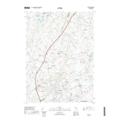
2018 Map of Hudson
USGS Topo · Published 2018About this map
The Assabet River winds through the heart of this industrial and residential landscape, anchoring the developed corridor from Hudson to Gleasondale. The map captures a complex mix of historic burial sites and modern infrastructure, from the Pan Burying Ground and Saint Michaels Cem to the Minute Man Air Field. The surrounding terrain is defined by prominent elevations like Vaughn Hills and Rattlesnake Hill, which separate the river valley from the more open lands near Bolton and Stow. Water features are abundant, including the recreational Bare Hill Pond and its various islands, such as Sheep Island and Spectacle Island. This survey also documents several youth camps, including Camp Resolute and Camp Virginia, reflecting the area's long-standing tradition as a site for seasonal recreation and community gathering.
Find a feature on this map
91 named features on this map. Tap any name to fly to it.
Don’t see what you’re looking for? This feature index may not catch every label — zoom into the map to look around manually.
Map Details
Editions of this 2018 Hudson Map
This is the sole edition of this map. No revisions or reprints were ever made.
Other maps of this area

1886 · Lowell
USGS Topo · 1:62,500

1886 · Framingham
USGS Topo · 1:62,500

1887 · Marlboro
USGS Topo · 1:62,500

1889 · Marlboro
USGS Topo · 1:62,500

1889 · Framingham
USGS Topo · 1:62,500

1893 · Lowell
USGS Topo · 1:62,500

1893 · Groton
USGS Topo · 1:62,500

1894 · Framingham
USGS Topo · 1:62,500

1896 · Marlboro
USGS Topo · 1:62,500

1898 · Marlboro
USGS Topo · 1:62,500