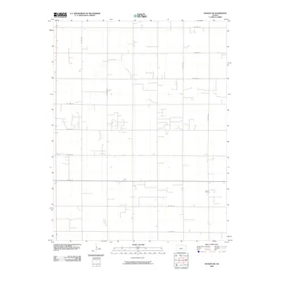
2009 Map of Hudson NW
USGS Topo · Published 2009About this map
The agrarian landscape of northern Stafford County is defined by a precise section-line road network and widely dispersed rural landmarks. Salem Cemetery stands as a primary cultural anchor in this region, serving as a vital point of reference for genealogists tracing local family histories. The map details the intersection of key transit corridors, such as NE 140th St and NE 20th Ave, which facilitate movement through the plains. This 2009 survey by the U.S. Geological Survey documents the persistent pattern of Kansas prairie development, where long-established cemetery sites and a geometric grid of unpaved and local roads provide the only breaks in the vast agricultural acreage.
Find a feature on this map
14 named features on this map. Tap any name to fly to it.
Don’t see what you’re looking for? This feature index may not catch every label — zoom into the map to look around manually.
Map Details
Editions of this 2009 Hudson NW Map
This is the sole edition of this map. No revisions or reprints were ever made.
Other maps of this area

1891 · Great Bend
USGS Topo · 1:125,000

1893 · Great Bend
USGS Topo · 1:125,000

1955 · Great Bend
USGS Topo · 1:250,000

1957 · Great Bend
USGS Topo · 1:250,000

1957 · Ellinwood SW
USGS Topo · 1:24,000

1957 · Ellinwood
USGS Topo · 1:24,000

1958 · Great Bend
USGS Topo · 1:250,000

1958 · Great Bend
USGS Topo · 1:24,000
1970 · Hudson NW
USGS Topo · 1:24,000
1970 · Seward
USGS Topo · 1:24,000