
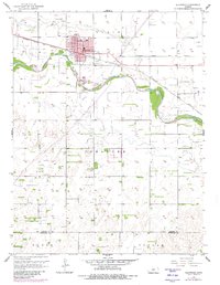
1957 Map of Ellinwood
USGS Topo · Published 1958About this map
The town of Ellinwood serves as the focal point of this mid-century survey, situated at a strategic bend of the Arkansas River. The landscape is a study in mid-continent industrial and social development, where the Atchison Topeka and Santa Fe railroad tracks run parallel to the river, supporting the local agricultural and extraction economies. Significant Oil Field activity is visible across the quadrangle, with numerous Oil Wells peppered throughout the sections, particularly in the townships of Lakin and Comanche.
Find a feature on this map
20 named features on this map. Tap any name to fly to it.
Don’t see what you’re looking for? This feature index may not catch every label — zoom into the map to look around manually.
Map Details
Editions of this 1957 Ellinwood Map
2 editions found
Other maps of this area

1891 · Great Bend
USGS Topo · 1:125,000

1893 · Great Bend
USGS Topo · 1:125,000

1894 · Lyons
USGS Topo · 1:125,000

1955 · Great Bend
USGS Topo · 1:250,000

1956 · Ellinwood NE
USGS Topo · 1:24,000

1956 · Ellinwood NW
USGS Topo · 1:24,000

1957 · Great Bend
USGS Topo · 1:250,000

1957 · Ellinwood SW
USGS Topo · 1:24,000

1958 · Great Bend
USGS Topo · 1:250,000

1967 · Alden NW
USGS Topo · 1:24,000