1957 Map of Ellinwood
USGS Topo · Published 1980About this map
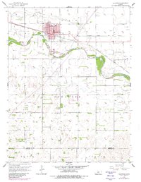
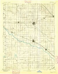
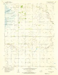
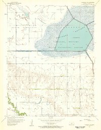
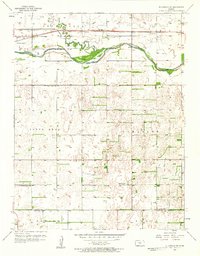
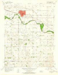
Ellinwood serves as the primary hub of this landscape, situated along the northern banks of the Arkansas River and defined by its connection to the Atchison Topeka and Santa Fe railroad. The town layout shows a developing community with essential services like a Hospital, while the perimeter includes social landmarks such as a Drive-in Theater and the Ellinwood Airport. To the south, the terrain transitions into an extensive Oil Field, where the industrial character of the region becomes evident through numerous derrick locations and pipelines. Local history and genealogy are anchored by the St Josephs Cem and the Ellinwood Ch, which stand as landmarks for the families of the surrounding townships, including Lakin and Comanche. This survey, updated with late-1970s aerial photography, captures the intersection of traditional agricultural township divisions with mid-century petroleum development.
Find a feature on this map
16 named features on this map. Tap any name to fly to it.
Don’t see what you’re looking for? This feature index may not catch every label — zoom into the map to look around manually.
Map Details
Editions of this 1957 Ellinwood Map
2 editions found
Other maps of this area

1891 · Great Bend
USGS Topo · 1:125,000

1893 · Great Bend
USGS Topo · 1:125,000
1894 · Lyons
USGS Topo · 1:125,000

1955 · Great Bend
USGS Topo · 1:250,000
1956 · Ellinwood NE
USGS Topo · 1:24,000
1956 · Ellinwood NW
USGS Topo · 1:24,000

1957 · Great Bend
USGS Topo · 1:250,000
1957 · Ellinwood SW
USGS Topo · 1:24,000
1957 · Ellinwood
USGS Topo · 1:24,000

1958 · Great Bend
USGS Topo · 1:250,000