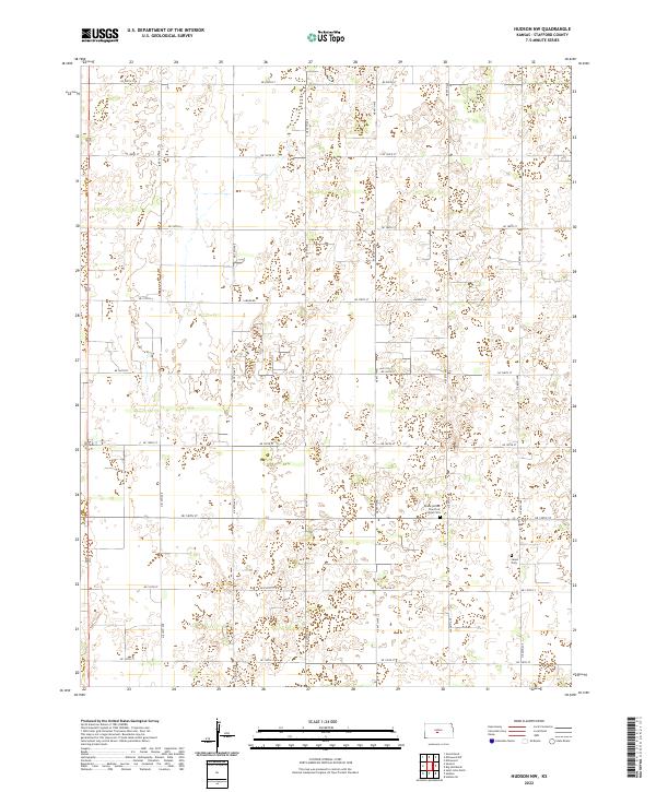
2022 Map of Hudson NW
USGS Topo · Published 2022About this map
Peace United Church of Christ Cem serves as a prominent landmark in this Stafford County landscape, reflecting the religious and community foundations of this central Kansas region. The terrain is defined by a grid of rural section roads, including Larned Rd and NE 140th St, which facilitate movement between the agricultural parcels of t21s r12w and t22s r12w. Another significant genealogical site, the Salem Cem, is situated further east along the range line. The pattern of development here is strictly organized by the Public Land Survey System, with numbered avenues and streets like NE 50th Ave providing the framework for the modern farming operations that continue to shape the local economy and social geography.
Find a feature on this map
23 named features on this map. Tap any name to fly to it.
Don’t see what you’re looking for? This feature index may not catch every label — zoom into the map to look around manually.
Map Details
Editions of this 2022 Hudson NW Map
This is the sole edition of this map. No revisions or reprints were ever made.
Other maps of this area

1891 · Great Bend
USGS Topo · 1:125,000

1893 · Great Bend
USGS Topo · 1:125,000

1955 · Great Bend
USGS Topo · 1:250,000

1957 · Great Bend
USGS Topo · 1:250,000

1957 · Ellinwood SW
USGS Topo · 1:24,000

1957 · Ellinwood
USGS Topo · 1:24,000

1958 · Great Bend
USGS Topo · 1:250,000

1958 · Great Bend
USGS Topo · 1:24,000
1970 · Hudson NW
USGS Topo · 1:24,000
1970 · Seward
USGS Topo · 1:24,000