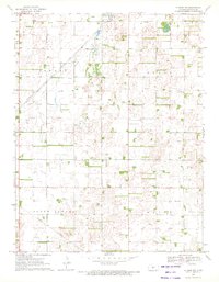
1970 Map of Hudson NW
USGS Topo · Published 1972About this map
The industrial and agricultural landscape of central Kansas is defined here by the extensive Oil Field development across Byron and Seward townships. Surveyed in 1969 and field checked in 1970, the map reveals a dense network of Pipelines and numerous Oil Wells that underscore the region's energy economy. This subterranean activity is overlaid on a traditional grid of section lines, where community life is anchored by landmarks like Peace Ch and the Salem Cem.
Find a feature on this map
11 named features on this map. Tap any name to fly to it.
Don’t see what you’re looking for? This feature index may not catch every label — zoom into the map to look around manually.
Map Details
Editions of this 1970 Hudson NW Map
This is the sole edition of this map. No revisions or reprints were ever made.
Other maps of this area

1891 · Great Bend
USGS Topo · 1:125,000

1893 · Great Bend
USGS Topo · 1:125,000

1955 · Great Bend
USGS Topo · 1:250,000

1957 · Great Bend
USGS Topo · 1:250,000

1957 · Ellinwood SW
USGS Topo · 1:24,000

1957 · Ellinwood
USGS Topo · 1:24,000

1958 · Great Bend
USGS Topo · 1:250,000

1958 · Great Bend
USGS Topo · 1:24,000
1970 · Seward
USGS Topo · 1:24,000
1971 · Hudson SE
USGS Topo · 1:24,000