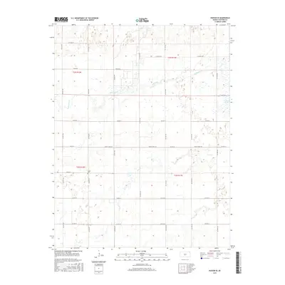
2015 Map of Hudson SE
USGS Topo · Published 2015About this map
Strobe Cem stands as a quiet landmark amidst the gridded section lines of Stafford County, located just north of NE 60th St. This landscape is defined by its gentle hydrology, where the meandering paths of Rattlesnake Cr and Peace Cr cut across the geometric regularity of the rural road network. To the northeast, the presence of the Little Salt Marsh indicates the specialized alkaline wetland environments characteristic of this part of the Great Bend Prairie. The map reveals a highly structured agricultural interior, partitioned by a dense lattice of named avenues and streets such as Hudson Rd and S Sterling Rd, reflecting a century of systematic land division. This documentation captures the precise alignment of property boundaries and watercourses in the mid-2010s, serving as a reliable record for those tracing family land holdings or local drainage patterns.
Find a feature on this map
24 named features on this map. Tap any name to fly to it.
Don’t see what you’re looking for? This feature index may not catch every label — zoom into the map to look around manually.
Map Details
Editions of this 2015 Hudson SE Map
This is the sole edition of this map. No revisions or reprints were ever made.
Other maps of this area

1891 · Great Bend
USGS Topo · 1:125,000

1892 · Kingman
USGS Topo · 1:125,000

1892 · Pratt
USGS Topo · 1:125,000

1893 · Great Bend
USGS Topo · 1:125,000

1894 · Kingman
USGS Topo · 1:125,000

1894 · Pratt
USGS Topo · 1:125,000

1894 · Lyons
USGS Topo · 1:125,000

1955 · Great Bend
USGS Topo · 1:250,000

1955 · Pratt
USGS Topo · 1:250,000

1957 · Great Bend
USGS Topo · 1:250,000