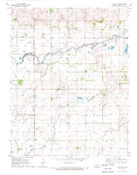
1971 Map of Hudson SE
USGS Topo · Published 1972About this map
Rattlesnake Creek and Peace Creek wind through the flat landscape of Stafford County, defining the hydrology of this agricultural region. The northeastern corner is dominated by the Quivira National Wildlife Refuge, featuring the Little Salt Marsh, a critical ecological site for migratory birds. This 1971 survey captures the area’s dependence on both its natural water resources and its industrial development, with numerous Oil Wells scattered across the northern sections of Hayes and Putnam townships.
Find a feature on this map
14 named features on this map. Tap any name to fly to it.
Don’t see what you’re looking for? This feature index may not catch every label — zoom into the map to look around manually.
Map Details
Editions of this 1971 Hudson SE Map
This is the sole edition of this map. No revisions or reprints were ever made.
Other maps of this area

1891 · Great Bend
USGS Topo · 1:125,000

1892 · Kingman
USGS Topo · 1:125,000

1892 · Pratt
USGS Topo · 1:125,000

1893 · Great Bend
USGS Topo · 1:125,000

1894 · Kingman
USGS Topo · 1:125,000

1894 · Pratt
USGS Topo · 1:125,000

1894 · Lyons
USGS Topo · 1:125,000

1955 · Great Bend
USGS Topo · 1:250,000

1955 · Pratt
USGS Topo · 1:250,000

1957 · Great Bend
USGS Topo · 1:250,000