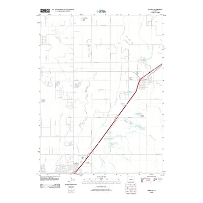
2010 Map of Hudson
USGS Topo · Published 2010About this map
The Hudson area of the High Plains is defined by a sophisticated network of early 21st-century water management, where numerous named reservoirs and irrigation canals dictate the settlement pattern. From Carlin Reservoir in the north to Henry Reservoir near Tonville, these man-made features support the agricultural character of the region. The map captures the interaction between residential growth in Lochbuie and the vital transport corridors of the interstate and Platte Valley Airpark.
Find a feature on this map
63 named features on this map. Tap any name to fly to it.
Don’t see what you’re looking for? This feature index may not catch every label — zoom into the map to look around manually.
Map Details
Editions of this 2010 Hudson Map
This is the sole edition of this map. No revisions or reprints were ever made.
Other maps of this area

1890 · East Denver
USGS Topo · 1:125,000

1902 · Greeley
USGS Topo · 1:125,000

1940 · Brighton
USGS Topo · 1:31,680

1942 · Mile High Lakes
USGS Topo · 1:31,680

1944 · Brighton
USGS Topo · 1:31,680

1949 · Fort Lupton
USGS Topo · 1:24,000

1949 · Platteville
USGS Topo · 1:24,000

1949 · Hudson
USGS Topo · 1:24,000

1950 · Platteville
USGS Topo · 1:24,000
1950 · Fort Lupton
USGS Topo · 1:24,000