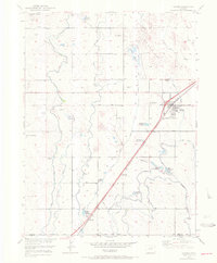
1971 Map of Hudson
USGS Topo · Published 1972About this map
Agricultural development and water management define the landscape around Hudson in this early 1970s revision, which incorporates data from the late 1940s. The region is dominated by an extensive network of irrigation infrastructure, including the Beebe Canal, Bowles Seep Canal, and the Burlington Extension Ditch. These waterways feed numerous small storage sites like Eshelman Reservoir and Carlin Reservoir, which are critical for farming on the high plains.
Find a feature on this map
28 named features on this map. Tap any name to fly to it.
Don’t see what you’re looking for? This feature index may not catch every label — zoom into the map to look around manually.
Map Details
Editions of this 1971 Hudson Map
This is the sole edition of this map. No revisions or reprints were ever made.
Other maps of this area

1890 · East Denver
USGS Topo · 1:125,000

1902 · Greeley
USGS Topo · 1:125,000

1940 · Brighton
USGS Topo · 1:31,680

1942 · Mile High Lakes
USGS Topo · 1:31,680

1944 · Brighton
USGS Topo · 1:31,680

1949 · Fort Lupton
USGS Topo · 1:24,000

1949 · Platteville
USGS Topo · 1:24,000

1949 · Hudson
USGS Topo · 1:24,000

1950 · Platteville
USGS Topo · 1:24,000
1950 · Fort Lupton
USGS Topo · 1:24,000