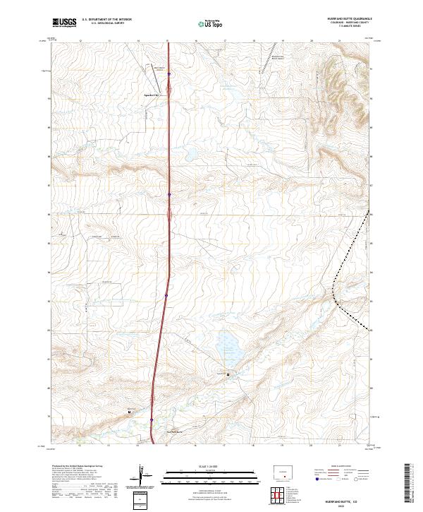
2022 Map of Huerfano Butte
USGS Topo · Published 2022About this map
The Huerfano River defines the southern portion of this landscape, its waters diverted through an intricate network of irrigation infrastructure including the Orlando Ditch, Bradford Canal, and Homestead Canal. This agricultural and ranching district is punctuated by volcanic features, most notably the namesake Huerfano Butte rising near the riverbanks. To the north, the small settlement of Apache City sits along the interstate corridor, surrounded by ephemeral drainage systems like Pope Arroyo, Apache Cr, and Greasewood Arroyo. This map captures a modern view of a rural landscape where water management is critical to the local economy. Genealogists and local historians can find several named landmarks including Speed Cem and Butte Cem, while aviation history is represented by private strips such as the Mann Ranch Airport and Diamond Star Ranch Airport. The presence of Sears Spring and various numbered reservoirs reflects the ongoing importance of water resources in this arid Colorado terrain.
Find a feature on this map
40 named features on this map. Tap any name to fly to it.
Don’t see what you’re looking for? This feature index may not catch every label — zoom into the map to look around manually.
Map Details
Editions of this 2022 Huerfano Butte Map
This is the sole edition of this map. No revisions or reprints were ever made.
Other maps of this area

1891 · Walsenburg
USGS Topo · 1:125,000

1894 · Walsenburg
USGS Topo · 1:125,000

1897 · Walsenburg
USGS Topo · 1:125,000

1900 · Walsenburg
USGS Topo · 1:125,000

1954 · Trinidad
USGS Topo · 1:250,000

1955 · Trinidad
USGS Topo · 1:250,000

1958 · Trinidad
USGS Topo · 1:250,000

1959 · Trinidad
USGS Topo · 1:250,000
1963 · Walsenburg North
USGS Topo · 1:24,000
1963 · Maria Reservoir
USGS Topo · 1:24,000