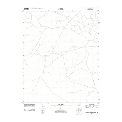
2010 Map of Huerfano Trading Post SW
USGS Topo · Published 2010About this map
De-na-zin Wash and Willow Wash define the drainage patterns of this high desert landscape in the Eastern Navajo Agency. This 2010 survey illustrates the transition of traditional transport routes into a modern network of local and federal roads. The intersection of Indian Service Route 7023 and various county roads, including County Rd-7610, highlights the infrastructure supporting rural residences and land management in this part of New Mexico. The presence of Alamo Wash further emphasizes the seasonal watercourses that have historically dictated movement and settlement across the terrain. Researchers will find a clear record of the area's geography just prior to the second decade of the twenty-first century, showing the exact alignment of roads like Indian Service Route 458.
Find a feature on this map
9 named features on this map. Tap any name to fly to it.
Don’t see what you’re looking for? This feature index may not catch every label — zoom into the map to look around manually.
Map Details
Editions of this 2010 Huerfano Trading Post SW Map
This is the sole edition of this map. No revisions or reprints were ever made.
Other maps of this area

1889 · Largo
USGS Topo · 1:250,000

1889 · Chaco
USGS Topo · 1:250,000

1892 · Chaco
USGS Topo · 1:250,000

1895 · Largo
USGS Topo · 1:250,000

1954 · Shiprock
USGS Topo · 1:250,000

1954 · Aztec
USGS Topo · 1:250,000

1958 · Shiprock
USGS Topo · 1:250,000

1958 · Aztec
USGS Topo · 1:250,000

1959 · Shiprock
USGS Topo · 1:250,000

1962 · Aztec
USGS Topo · 1:250,000