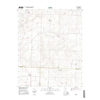
2017 Map of Huff
USGS Topo · Published 2017About this map
Huff and Midway anchor this landscape along the border of Independence, White, and Jackson Counties. The terrain is defined by a series of prominent rises including Salado Mtn, Bald Knob, and Major Harris Mtn, while the southern reaches descend toward Wildcat Bluff and Gray Hollow. Numerous family-named landmarks suggest a long-established rural community, evidenced by scattered burial grounds like Huff Cem, Riddles Cem, and Putman Cem. The drainage network is complex, with Departee Cr and Village Cr carving through the hills. This 2017 survey reflects the enduring character of these rural Arkansas uplands, where small settlements like Union Hill persist near natural features like Stanley Spring. The road network, including Batesville Blvd and Union Hill Rd, follows the contours of the land, connecting the isolated homesteads and churches of the region.
Find a feature on this map
78 named features on this map. Tap any name to fly to it.
Don’t see what you’re looking for? This feature index may not catch every label — zoom into the map to look around manually.
Map Details
Editions of this 2017 Huff Map
This is the sole edition of this map. No revisions or reprints were ever made.
Other maps of this area

1890 · Batesville
USGS Topo · 1:125,000

1891 · Batesville
USGS Topo · 1:125,000

1935 · Newport
USGS Topo · 1:62,500

1935 · Augusta
USGS Topo · 1:62,500

1935 · Bald Knob
USGS Topo · 1:62,500

1942 · Jamestown
USGS Topo · 1:31,680

1942 · Salado
USGS Topo · 1:31,680

1953 · Memphis
USGS Topo · 1:250,000

1956 · Memphis
USGS Topo · 1:250,000
1956 · Newark
USGS Topo · 1:24,000