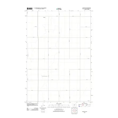
2012 Map of Huffton
USGS Topo · Published 2012About this map
Huffton occupies a central role in this northern South Dakota landscape, characterized by the rigid section-line grid of the Riverside Township. The terrain is defined by its agricultural layout, with long stretches of gravel roads like 405th Ave and 122nd St intersecting at regular intervals across the prairie. While the settlement of Huffton remains a primary point of reference, the southern portion of the quadrangle is anchored by the Groton Municipal Airport, providing a modern connection to the region's transportation network. This survey illustrates the sparse, organized development of Brown County, where the placement of roads such as 407th Ave and 127th St reflects the enduring reliance on a systematic land division that has shaped the area's farming identity for generations.
Find a feature on this map
16 named features on this map. Tap any name to fly to it.
Don’t see what you’re looking for? This feature index may not catch every label — zoom into the map to look around manually.
Map Details
Editions of this 2012 Huffton Map
This is the sole edition of this map. No revisions or reprints were ever made.
Other maps of this area

1895 · Aberdeen
USGS Topo · 1:125,000

1896 · Columbia
USGS Topo · 1:125,000

1952 · Huffton
USGS Topo · 1:24,000

1952 · Putney
USGS Topo · 1:24,000

1953 · Milbank
USGS Topo · 1:250,000

1954 · Groton
USGS Topo · 1:24,000

1954 · James
USGS Topo · 1:24,000

1954 · Daly Corners
USGS Topo · 1:24,000

1954 · Aberdeen
USGS Topo · 1:250,000

1956 · Aberdeen
USGS Topo · 1:250,000