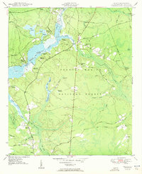
1950 Map of Huger
USGS Topo · Published 1950About this map
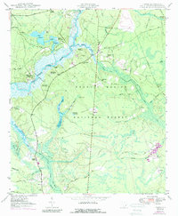
The East Branch Cooper River corridor dominates this Berkeley County landscape, revealing an intricate network of historical estates and lowcountry wetlands. Large properties like Bossis Plantation, Quinby Plantation, and Middleburg Plantation line the river, their boundaries defined by levees and private reserves such as Upper Reserve and Lower Reserve. The map documents a complex hydraulic history, with numerous canals, runs, and the Turpentine Dam situated within the Francis Marion National Forest.
Find a feature on this map
70 named features on this map. Tap any name to fly to it.
Don’t see what you’re looking for? This feature index may not catch every label — zoom into the map to look around manually.
Map Details
Editions of this 1950 Huger Map
5 editions found
Other maps of this area

1919 · Wando
USGS Topo · 1:21,120

1919 · Cordesville
USGS Topo · 1:48,000

1919 · Melgrove
USGS Topo · 1:21,120

1919 · Sewee Bay
USGS Topo · 1:21,120

1940 · Melgrove
USGS Topo · 1:24,000

1943 · Wando
USGS Topo · 1:24,000

1943 · Sewee Bay
USGS Topo · 1:24,000

1943 · Shulerville
USGS Topo · 1:24,000

1943 · Ocean Bay
USGS Topo · 1:24,000

1948 · James Island
USGS Topo · 1:250,000