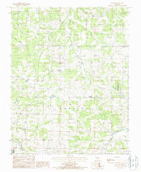
1987 Map of Huggins
USGS Topo · Published 1987About this map
Huggins and Bendavis serve as central points in this portion of the Ozarks, where the drainage systems of West Fork Roubidoux Creek and Beaver Creek define the local topography. This 1980s landscape shows a transition toward conservation, anchored by the Pairlee Freeman Barnes State Wildlife Area along Spurlock Hollow. Small rural settlements like Upton and Fairview are connected by a network of unimproved roads and ford crossings, particularly along the North Fork and Sycamore Creek. Local landmarks such as a prominent Radio Tower near Bendavis and several scattered Cem sites provide specific points of interest for genealogists and local historians tracing the development of the Morris and Upton townships. The map documents a landscape of hollows and creeks, including Pollock Creek and Doolittle Creek, before more modern development patterns altered these Ozark communities.
Find a feature on this map
22 named features on this map. Tap any name to fly to it.
Don’t see what you’re looking for? This feature index may not catch every label — zoom into the map to look around manually.
Map Details
Editions of this 1987 Huggins Map
This is the sole edition of this map. No revisions or reprints were ever made.
Other maps of this area

1931 · Manes
USGS Topo · 1:48,000

1941 · Manes
USGS Topo · 1:62,500

1941 · Bado
USGS Topo · 1:62,500

1943 · Manes
USGS Topo · 1:62,500

1943 · Bado
USGS Topo · 1:62,500

1951 · Mountain Grove North
USGS Topo · 1:24,000

1951 · Cabool NW
USGS Topo · 1:24,000

1951 · Cabool NE
USGS Topo · 1:24,000

1951 · Cabool
USGS Topo · 1:62,500

1951 · Mountain Grove
USGS Topo · 1:62,500