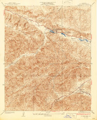
1937 Map of Hughes Lake
USGS Topo · Published 1937About this map
San Andreas Rift Zone geology defines the upper reaches of this Los Angeles County study, where a series of sag ponds and fault-line depressions have created a unique string of high-elevation lakes. The settlement at Hughes Lake Lake Hughes P O serves as a primary local hub, connected by the winding Elizabeth Lake Road to the Munz Ranch and Elizabeth Lake further east. Much of the southern half of the map is dominated by the steep, drainage-cut slopes of the Angeles National Forest, including the prominent Grass Mtn. The landscape reveals a transition from these protected forest heights to the pocketed flats of Juday Flat, while the lower southeast corner shows early development around La Joya and Dowd near Spunky Canyon. Notable infrastructure like the Pine Canyon County Patrol Sta and various firebreaks underscore the era's focus on forest management and fire prevention in this canyon-heavy terrain.
Find a feature on this map
32 named features on this map. Tap any name to fly to it.
Don’t see what you’re looking for? This feature index may not catch every label — zoom into the map to look around manually.
Map Details
Editions of this 1937 Hughes Lake Map
2 editions found
Other maps of this area

1903 · Tejon
USGS Topo · 1:125,000

1915 · Elizabeth Lake
USGS Topo · 1:125,000

1917 · Elizabeth Lake
USGS Topo · 1:125,000

1931 · Red Mountain
USGS Topo · 1:24,000

1931 · Warm Spring
USGS Topo · 1:24,000

1931 · Little Buttes
USGS Topo · 1:24,000
1932 · La Brun
USGS Topo · 1:24,000

1932 · Lake
USGS Topo · 1:24,000
1932 · Mint Canyon
USGS Topo · 1:24,000

1932 · Hughes Lake
USGS Topo · 1:24,000