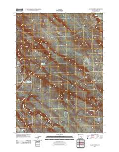
2011 Map of Hughet Spring
USGS Topo · Published 2011About this map
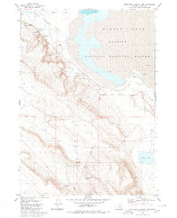
Warm Springs Valley and the surrounding high desert plateau dominate this corner of Harney County, where water is the primary geographic driver. The landscape is defined by its intermittent hydrology, featuring ephemeral bodies like Chicken Feed Lake and Buzzard Lake alongside man-made improvements designed to capture seasonal runoff. These water management features, including Yellow Spot Reservoir, Teddy Spring Reservoir, and Stud-Horse Reservoir, illustrate the essential infrastructure required for ranching in this arid region. The drainage of Buzzard Creek snakes across the southern portion of the sheet, while the namesake Hughet Spring emerges in the northeast. Topographic relief is minimal, though the distinct formation of Round Butte serves as a clear landmark above the surrounding flats and Round Butte Lake.
Find a feature on this map
10 named features on this map. Tap any name to fly to it.
Don’t see what you’re looking for? This feature index may not catch every label — zoom into the map to look around manually.
Map Details
Editions of this 2011 Hughet Spring Map
This is the sole edition of this map. No revisions or reprints were ever made.
Other maps of this area

1955 · Burns
USGS Topo · 1:250,000

1958 · Burns
USGS Topo · 1:250,000

1959 · Burns
USGS Topo · 1:250,000

1959 · Dog Mountain
USGS Topo · 1:62,500
1980 · Hughet Spring
USGS Topo · 1:24,000
1980 · Meadow Lake
USGS Topo · 1:24,000

1980 · Lunch Lake
USGS Topo · 1:24,000
1980 · Flybee Lake
USGS Topo · 1:24,000

1980 · Iron Mtn. Flat
USGS Topo · 1:24,000
1980 · Southwest Harney Lake
USGS Topo · 1:24,000