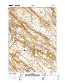
2014 Map of Hughet Spring
USGS Topo · Published 2014About this map
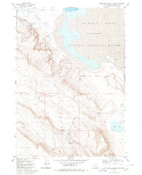
Warm Springs Valley defines the northern reaches of this high-desert landscape in Harney County, where the management of water is central to the land's utility. The terrain is marked by a series of engineered water catchments, including Yellow Spot Reservoir, Stud Horse Reservoir, and Teddy Spring Reservoir, which support livestock or local ecology in an otherwise arid environment. Natural water features like Hughet Spring and the drainage of Buzzard Cr flow toward the seasonal Buzzard Lake in the southwest corner. The topography rises toward the southeast, where Round Butte stands as a prominent landmark near Round Butte Lake. This map captures a specific pastoral and hydrological infrastructure typical of the Oregon high desert in the early 21st century.
Find a feature on this map
13 named features on this map. Tap any name to fly to it.
Don’t see what you’re looking for? This feature index may not catch every label — zoom into the map to look around manually.
Map Details
Editions of this 2014 Hughet Spring Map
This is the sole edition of this map. No revisions or reprints were ever made.
Other maps of this area

1955 · Burns
USGS Topo · 1:250,000

1958 · Burns
USGS Topo · 1:250,000

1959 · Burns
USGS Topo · 1:250,000

1959 · Dog Mountain
USGS Topo · 1:62,500
1980 · Hughet Spring
USGS Topo · 1:24,000
1980 · Meadow Lake
USGS Topo · 1:24,000

1980 · Lunch Lake
USGS Topo · 1:24,000
1980 · Flybee Lake
USGS Topo · 1:24,000

1980 · Iron Mtn. Flat
USGS Topo · 1:24,000
1980 · Southwest Harney Lake
USGS Topo · 1:24,000