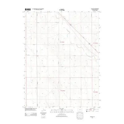
2013 Map of Hugo SW
USGS Topo · Published 2013About this map
Big Sandy Creek winds through the southeastern plains of Lincoln County, defining the drainage patterns of this high-plains landscape. The map reveals a strictly organized section-line road network, where routes like CO Road 109 and CO Road 34 segment the open range into the traditional townships and ranges of the Public Land Survey System. The diagonal strike of Us-287 N cuts across this grid, following the natural northwest-to-southeast corridor of the Big Sandy Creek valley. A primary point of interest for local historians is the Liberty Cem, a small burial ground situated at the junction of CO Road 109 and CO Road 25, serving as a quiet marker of the families who settled this expansive agricultural territory.
Find a feature on this map
22 named features on this map. Tap any name to fly to it.
Don’t see what you’re looking for? This feature index may not catch every label — zoom into the map to look around manually.
Map Details
Editions of this 2013 Hugo SW Map
This is the sole edition of this map. No revisions or reprints were ever made.
Other maps of this area

1889 · Sanborn
USGS Topo · 1:125,000

1891 · Sanborn
USGS Topo · 1:125,000

1891 · Arroyo
USGS Topo · 1:125,000

1891 · Limon
USGS Topo · 1:125,000

1892 · Limon
USGS Topo · 1:125,000

1893 · Arroyo
USGS Topo · 1:125,000

1893 · Sanborn
USGS Topo · 1:125,000

1954 · Limon
USGS Topo · 1:250,000

1954 · Lamar
USGS Topo · 1:250,000

1957 · Limon
USGS Topo · 1:250,000