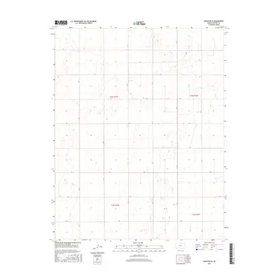
2015 Map of Hugoton SE
USGS Topo · Published 2015About this map
Stevens County's high plains terrain is defined by a rigorous township and range grid system in this 2015 survey. The landscape is segmented into four primary quadrants—T34s R37w, T34s R36w, T35s R37w, and T35s R36w—reflecting the systematic land division of the American West. A network of rural roads, including Rd 14, Rd 16, and Rd 12, follows these section lines, facilitating agricultural transit across the open flats. The map illustrates a series of depression contours and seasonal wetlands, typical of the playa lakes found throughout the Great Plains. While the area is sparsely settled, the detailed labeling of rural routes such as Rd H, Rd F, and Rd D provides a precise framework for understanding the 21st-century spatial organization of this Kansas corner.
Find a feature on this map
23 named features on this map. Tap any name to fly to it.
Don’t see what you’re looking for? This feature index may not catch every label — zoom into the map to look around manually.
Map Details
Editions of this 2015 Hugoton SE Map
This is the sole edition of this map. No revisions or reprints were ever made.
Other maps of this area

1954 · Perryton
USGS Topo · 1:250,000

1955 · Dodge City
USGS Topo · 1:250,000

1958 · Perryton
USGS Topo · 1:250,000

1958 · Dodge City
USGS Topo · 1:250,000

1959 · Dodge City
USGS Topo · 1:250,000

1967 · Straight
USGS Topo · 1:24,000

1967 · Straight NE
USGS Topo · 1:24,000

1967 · Hooker NW
USGS Topo · 1:24,000
1974 · Hugoton SE
USGS Topo · 1:24,000

1974 · Hugoton
USGS Topo · 1:24,000