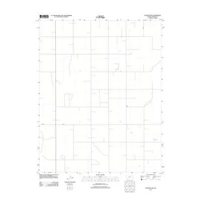
2012 Map of Hugoton SW
USGS Topo · Published 2012About this map
Stevens County agricultural lands define this southwest portion of Kansas during the early 2010s. The landscape is characterized by a precise, section-line grid of rural thoroughfares, including Road 10, which runs north-to-south along the eastern edge of the quadrangle. This area of the High Plains reflects the systematic land division common in the region, with local transit facilitated by corridors like 9mi Rd and D Blvd. The map highlights a largely open rural expanse, occasionally punctuated by small structures and water catchment features typical of modern High Plains farming operations. Produced by the U.S. Geological Survey, this sheet provides a clear look at the spatial organization of the county's western reach during a period of established industrial agriculture.
Find a feature on this map
3 named features on this map. Tap any name to fly to it.
Don’t see what you’re looking for? This feature index may not catch every label — zoom into the map to look around manually.
Map Details
Editions of this 2012 Hugoton SW Map
This is the sole edition of this map. No revisions or reprints were ever made.
Other maps of this area

1954 · Perryton
USGS Topo · 1:250,000

1955 · Dodge City
USGS Topo · 1:250,000

1958 · Perryton
USGS Topo · 1:250,000

1958 · Dodge City
USGS Topo · 1:250,000

1959 · Dodge City
USGS Topo · 1:250,000

1967 · Straight
USGS Topo · 1:24,000

1967 · Straight NE
USGS Topo · 1:24,000

1973 · Rolla NE
USGS Topo · 1:24,000

1973 · Hough NE
USGS Topo · 1:24,000
1974 · Rolla SE
USGS Topo · 1:24,000