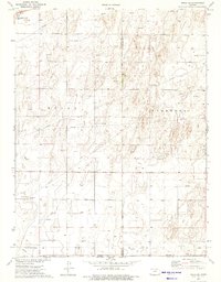
1974 Map of Rolla SE
USGS Topo · Published 1975About this map
Rolla anchors the northwestern corner of this mid-1970s survey, a period when energy infrastructure heavily defined the borderlands of Morton and Stevens counties. The industrial character of the landscape is marked by an extensive network of Gas Wells and an intricate system of pipelines that traverse the terrain. Notable landmarks include a Compressor Station and Radio Tower, indicating the technological and utility focus of the region. Transportation is anchored by the A T & S F railroad line, which skirts the town of Rolla near the Sewage Disposal Ponds. The map also documents the political geography of the High Plains, illustrating the intersection of the Kansas Oklahoma state line and several county boundaries including Morton Co Stevens Co and Morton Co Texas Co.
Find a feature on this map
14 named features on this map. Tap any name to fly to it.
Don’t see what you’re looking for? This feature index may not catch every label — zoom into the map to look around manually.
Map Details
Editions of this 1974 Rolla SE Map
2 editions found
Other maps of this area

1954 · Perryton
USGS Topo · 1:250,000

1955 · Dodge City
USGS Topo · 1:250,000

1958 · Perryton
USGS Topo · 1:250,000

1958 · Dodge City
USGS Topo · 1:250,000

1959 · Dodge City
USGS Topo · 1:250,000

1967 · Straight
USGS Topo · 1:24,000

1973 · Rolla NW
USGS Topo · 1:24,000

1973 · Rolla NE
USGS Topo · 1:24,000

1973 · Hough NE
USGS Topo · 1:24,000

1973 · Hough NW
USGS Topo · 1:24,000