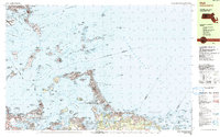
1984 Map of Hull
USGS Topo · Published 1984About this map
The narrow peninsula of Hull and the surrounding islands of Boston Harbor define this mid-1980s coastal survey. The complex maritime geography of the region is evident in the network of shipping channels like President Roads and The Narrows, which navigate between prominent landforms such as Long Island and Peddocks Island. Defensive history is prominent through the coastal fortifications of Fort Warren, Fort Standish, and Fort Dawes, marking strategic points across the harbor.
Find a feature on this map
62 named features on this map. Tap any name to fly to it.
Don’t see what you’re looking for? This feature index may not catch every label — zoom into the map to look around manually.
Map Details
Editions of this 1984 Hull Map
This is the sole edition of this map. No revisions or reprints were ever made.
Other maps of this area

1885 · Abington
USGS Topo · 1:62,500

1885 · Duxbury
USGS Topo · 1:62,500

1886 · Dedham
USGS Topo · 1:62,500

1888 · Duxbury
USGS Topo · 1:62,500

1888 · Abington
USGS Topo · 1:62,500

1892 · Boston Bay
USGS Topo · 1:62,500

1893 · Abington
USGS Topo · 1:62,500

1893 · Boston
USGS Topo · 1:62,500

1893 · Duxbury
USGS Topo · 1:62,500

1894 · Dedham
USGS Topo · 1:62,500