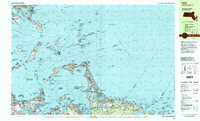
1997 Map of Hull
USGS Topo · Published 1999About this map
The peninsula of Hull and its surrounding archipelago define the maritime landscape of this late-twentieth-century survey. Extending from Pemberton through the narrow stretches of Windermere and Kenberma to Hampton, the map captures a densely settled coastal community anchored by Nantasket Ave. The strategic military history of the outer harbor is evident in the presence of Fort Warren on Georges Island, Fort Standish on Lovell Island, and Fort Dawes on Deer Island, marking the historic defenses of President Roads.
Find a feature on this map
205 named features on this map. Tap any name to fly to it.
Don’t see what you’re looking for? This feature index may not catch every label — zoom into the map to look around manually.
Map Details
Editions of this 1997 Hull Map
This is the sole edition of this map. No revisions or reprints were ever made.
Other maps of this area

1885 · Abington
USGS Topo · 1:62,500

1885 · Duxbury
USGS Topo · 1:62,500

1886 · Dedham
USGS Topo · 1:62,500

1888 · Duxbury
USGS Topo · 1:62,500

1888 · Abington
USGS Topo · 1:62,500

1892 · Boston Bay
USGS Topo · 1:62,500

1893 · Abington
USGS Topo · 1:62,500

1893 · Boston
USGS Topo · 1:62,500

1893 · Duxbury
USGS Topo · 1:62,500

1894 · Dedham
USGS Topo · 1:62,500