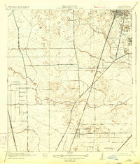
1919 Map of Humble
USGS Topo · Published 1933About this map
Humble and the surrounding Harris County countryside appear at a significant moment of industrial and infrastructure development in this 1919 survey. The town site is notably marked by large clusters of Oil Tanks, reflecting the region's oil boom economy of the early twentieth century. This industrial activity is served by a dense network of transit, including the Southern Pacific (Houston and East Texas Branch) and the Beaumont Sour Lake and Western railroads.
Find a feature on this map
18 named features on this map. Tap any name to fly to it.
Don’t see what you’re looking for? This feature index may not catch every label — zoom into the map to look around manually.
Map Details
Editions of this 1919 Humble Map
3 editions found
Other maps of this area

1915 · Houston Heights
USGS Topo · 1:24,000

1916 · Aldine
USGS Topo · 1:24,000

1916 · Settegast
USGS Topo · 1:24,000

1916 · Fauna
USGS Topo · 1:24,000

1916 · Harmaston
USGS Topo · 1:24,000

1916 · Moonshine Hill
USGS Topo · 1:24,000

1916 · Humble
USGS Topo · 1:24,000

1916 · Spring
USGS Topo · 1:24,000

1919 · Aldine
USGS Topo · 1:31,680

1919 · Humble
USGS Topo · 1:31,680