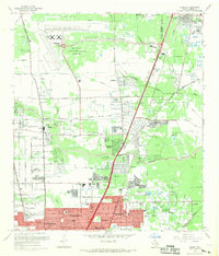
1967 Map of Humble
USGS Topo · Published 1969About this map
Houston Intercontinental Airport dominates the northwestern landscape of this survey, reflecting the rapid infrastructure expansion of the late 1960s north of the city. While the airfield features its Control Tower and Water Tanks, the surrounding area retains its suburban and rural character, marked by a high density of educational institutions such as Douglas MacArthur High Sch and Hambrick Jr High Sch. Residential developments like Greenwood Village and Parkwood Estates sit alongside numerous family burial grounds and memorial parks, including Rosewood Park Cem and Brookside Memorial Park (Cem). The natural drainage of the Gulf Coastal Plain is visible through the winding paths of Garners Bayou and Greens Bayou, which intersect the path of the Southern Pacific and Missouri Pacific railroads, signaling the enduring importance of rail transport in the Humble area.
Find a feature on this map
74 named features on this map. Tap any name to fly to it.
Don’t see what you’re looking for? This feature index may not catch every label — zoom into the map to look around manually.
Map Details
Editions of this 1967 Humble Map
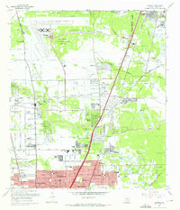
2 editions found
Other maps of this area

1915 · Houston Heights
USGS Topo · 1:24,000

1916 · Aldine
USGS Topo · 1:24,000

1916 · Settegast
USGS Topo · 1:24,000

1916 · Fauna
USGS Topo · 1:24,000

1916 · Harmaston
USGS Topo · 1:24,000

1916 · Moonshine Hill
USGS Topo · 1:24,000

1916 · Humble
USGS Topo · 1:24,000

1916 · Spring
USGS Topo · 1:24,000

1919 · Aldine
USGS Topo · 1:31,680

1919 · Humble
USGS Topo · 1:31,680