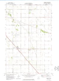
1974 Map of Humboldt
USGS Topo · Published 1976About this map
Humboldt sits at a geographic crossroads in the northwestern corner of the state, positioned where the Burlington Northern and Soo Line railroads intersect. This 1974 survey illustrates a flat, agricultural landscape defined by the drainage patterns of the Joe River and Salt Coulee, alongside an extensive network of infrastructure such as County Ditch No 28 and multiple pipelines. Local aviation and navigation are represented by the Bockwitz Landing Strip and a prominent Radio Tower just south of the town center.
Find a feature on this map
24 named features on this map. Tap any name to fly to it.
Don’t see what you’re looking for? This feature index may not catch every label — zoom into the map to look around manually.
Map Details
Editions of this 1974 Humboldt Map
This is the sole edition of this map. No revisions or reprints were ever made.
Other maps of this area

1939 · Pembina
USGS Topo · 1:62,500

1941 · Hallock
USGS Topo · 1:62,500

1941 · Pembina
USGS Topo · 1:62,500

1952 · Thief River Falls
USGS Topo · 1:250,000

1956 · Thief River Falls
USGS Topo · 1:250,000

1957 · Thief River Falls
USGS Topo · 1:250,000

1967 · Thief River Falls
USGS Topo · 1:250,000
1972 · Joliette
USGS Topo · 1:24,000
1972 · Pembina
USGS Topo · 1:24,000
1974 · Hill Siding
USGS Topo · 1:24,000