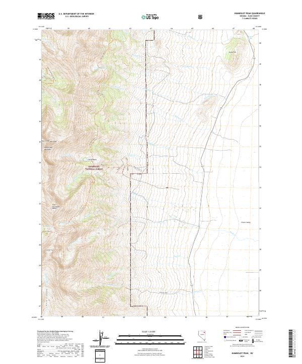
2021 Map of Humboldt Peak
USGS Topo · Published 2021About this map
Humboldt Peak and the high alpine terrain of the East Humboldt Range dominate this corner of Elko County, where the landscape transitions from steep granite ridges to the broad drainage of Clover Valley. The area is characterized by a concentrated network of high-altitude water bodies and glacial features, including Winchell Lake, Steele Lake, and the distinctive Hole in the Mountain. Many of these features are tucked within the eastern reaches of the Humboldt National Forest, accessible via a system of primitive routes like the East Humboldt Highline Trail and the Weeks Trail. Along the eastern edge, the terrain levels out near the settlement of Johnson Creek, showing how the mountain snowmelt feeds vital water sources such as the Franklin River and Chase Creek, which supported the early ranching and transit corridors of the Great Basin.
Find a feature on this map
42 named features on this map. Tap any name to fly to it.
Don’t see what you’re looking for? This feature index may not catch every label — zoom into the map to look around manually.
Map Details
Editions of this 2021 Humboldt Peak Map
This is the sole edition of this map. No revisions or reprints were ever made.
Other maps of this area

1935 · Halleck
USGS Topo · 1:125,000

1955 · Wells
USGS Topo · 1:250,000

1955 · Elko
USGS Topo · 1:250,000

1958 · Wells
USGS Topo · 1:250,000

1958 · Elko
USGS Topo · 1:250,000

1961 · Wells
USGS Topo · 1:250,000

1962 · Elko
USGS Topo · 1:250,000

1965 · Elko
USGS Topo · 1:250,000

1967 · Welcome
USGS Topo · 1:24,000

1967 · Herder Creek
USGS Topo · 1:24,000