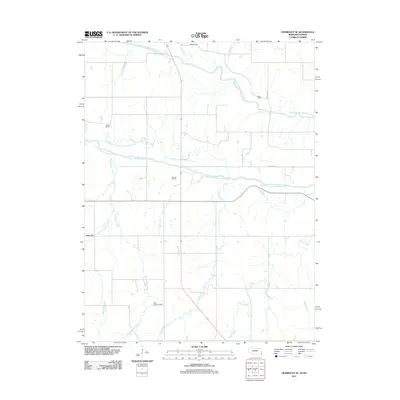
2011 Map of Humboldt SE
USGS Topo · Published 2011About this map
The North Fork Big Nemaha River and South Fork Big Nemaha River define the hydraulic landscape of this Richardson County region, showing a complex network of active and former watercourses. This map documents the Old Channel South Fork Nemaha River, illustrating how the waterway has been managed or altered over time near the Dawson Oil Field. Local history is anchored by rural settlements like New Salem and Nim City, alongside family-named landmarks such as the Miles Ranch. For genealogists and researchers, the placement of the Iliff Cemetery near Barneys Branch and the Wild Rose Cemetery further south provides precise locations for ancestral study. The terrain is deeply etched by numerous tributaries, including Rattlesnake Creek, Holy Creek, and Honey Creek, which feed into the primary river systems that cross the quadrangle.
Find a feature on this map
22 named features on this map. Tap any name to fly to it.
Don’t see what you’re looking for? This feature index may not catch every label — zoom into the map to look around manually.
Map Details
Editions of this 2011 Humboldt SE Map
This is the sole edition of this map. No revisions or reprints were ever made.
Other maps of this area

1888 · Hiawatha
USGS Topo · 1:125,000

1894 · Hiawatha
USGS Topo · 1:125,000

1915 · Falls City
USGS Topo · 1:62,500

1916 · Humboldt
USGS Topo · 1:62,500

1950 · Kansas City
USGS Topo · 1:250,000

1954 · Kansas City
USGS Topo · 1:250,000

1955 · Nebraska City
USGS Topo · 1:250,000

1956 · Kansas City
USGS Topo · 1:250,000

1957 · Nebraska City
USGS Topo · 1:250,000

1958 · Nebraska City
USGS Topo · 1:250,000