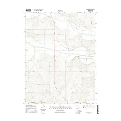
2014 Map of Humboldt SE
USGS Topo · Published 2014About this map
The North Fork Big Nemaha River and South Fork Big Nemaha River converge in this corner of Richardson County, Nebraska, creating a complex drainage system defined by an intricate network of creeks. The landscape is marked by the Old Channel S Fork Nemaha River, revealing the natural shifts of the waterway over time. Small settlements like Nim City and local burial grounds, including Wild Rose Cem and Iliff Cem, anchor the rural community. A dense web of section roads and trails, such as 640 Blvd and 706 Rd, provides access across the broken terrain carved by Rattlesnake Cr, Honey Cr, and Cottonwood Cr. This modern survey documents the persistent agricultural and hydrological patterns of the Nebraska-Kansas border region.
Find a feature on this map
32 named features on this map. Tap any name to fly to it.
Don’t see what you’re looking for? This feature index may not catch every label — zoom into the map to look around manually.
Map Details
Editions of this 2014 Humboldt SE Map
This is the sole edition of this map. No revisions or reprints were ever made.
Other maps of this area

1888 · Hiawatha
USGS Topo · 1:125,000

1894 · Hiawatha
USGS Topo · 1:125,000

1915 · Falls City
USGS Topo · 1:62,500

1916 · Humboldt
USGS Topo · 1:62,500

1950 · Kansas City
USGS Topo · 1:250,000

1954 · Kansas City
USGS Topo · 1:250,000

1955 · Nebraska City
USGS Topo · 1:250,000

1956 · Kansas City
USGS Topo · 1:250,000

1957 · Nebraska City
USGS Topo · 1:250,000

1958 · Nebraska City
USGS Topo · 1:250,000