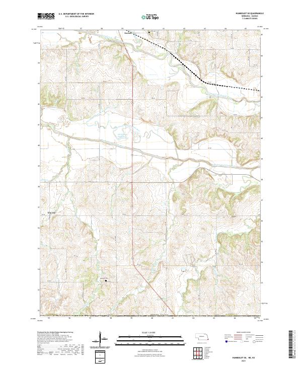
2021 Map of Humboldt SE
USGS Topo · Published 2021About this map
The North Fork Big Nemaha River and South Fork Big Nemaha River converge in this southeastern corner of Richardson County, defining a landscape of alluvial bottoms and rolling uplands. The drainage patterns are complex, featuring the Old Channel South Fork Nemaha River alongside numerous active tributaries like Rattlesnake Cr and Honey Cr. This 2021 survey illustrates the rural character of the region, where the town of Dawson serves as a northern anchor and the smaller cluster of Nim City sits to the west. Local genealogy is well-supported by the documentation of family and community burial sites, including Wild Rose Cem and Iliff Cem, which remain as persistent landmarks in the agricultural grid. The network of county roads, such as 703 RD and 705 RD, follows the section lines of the Public Land Survey System, reflecting the long-established settlement geometry of the Nebraska-Kansas borderlands.
Find a feature on this map
35 named features on this map. Tap any name to fly to it.
Don’t see what you’re looking for? This feature index may not catch every label — zoom into the map to look around manually.
Map Details
Editions of this 2021 Humboldt SE Map
This is the sole edition of this map. No revisions or reprints were ever made.
Other maps of this area

1888 · Hiawatha
USGS Topo · 1:125,000

1894 · Hiawatha
USGS Topo · 1:125,000

1915 · Falls City
USGS Topo · 1:62,500

1916 · Humboldt
USGS Topo · 1:62,500

1950 · Kansas City
USGS Topo · 1:250,000

1954 · Kansas City
USGS Topo · 1:250,000

1955 · Nebraska City
USGS Topo · 1:250,000

1956 · Kansas City
USGS Topo · 1:250,000

1957 · Nebraska City
USGS Topo · 1:250,000

1958 · Nebraska City
USGS Topo · 1:250,000