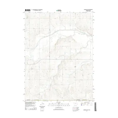
2014 Map of Humboldt SW
USGS Topo · Published 2014About this map
The South Fork Big Nemaha River carves a distinct path across the northern reaches of this Richardson County landscape, where the agricultural grid of the Great Plains meets the intricate drainage systems of the Missouri River watershed. This 2014 survey documents a terrain defined by intermittent waterways and deep-cut creek beds, including the winding course of Fourmile Cr and its tributaries. These features reveal the natural erosion patterns that have shaped the region's farming and ranching boundaries for generations. Along the eastern edge, Easly Cr flows through the undulating topography, illustrating the connectivity between the upland fields and the larger river basin. The map serves as a contemporary record of the Nebraska-Kansas borderland, preserving the exact hydrological and road network of the early 21st century.
Find a feature on this map
3 named features on this map. Tap any name to fly to it.
Don’t see what you’re looking for? This feature index may not catch every label — zoom into the map to look around manually.
Map Details
Editions of this 2014 Humboldt SW Map
This is the sole edition of this map. No revisions or reprints were ever made.
Other maps of this area

1888 · Hiawatha
USGS Topo · 1:125,000

1889 · Seneca
USGS Topo · 1:125,000

1894 · Seneca
USGS Topo · 1:125,000

1894 · Hiawatha
USGS Topo · 1:125,000

1916 · Humboldt
USGS Topo · 1:62,500

1950 · Kansas City
USGS Topo · 1:250,000

1954 · Kansas City
USGS Topo · 1:250,000

1955 · Manhattan
USGS Topo · 1:250,000

1955 · Nebraska City
USGS Topo · 1:250,000

1955 · Lincoln
USGS Topo · 1:250,000