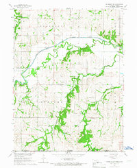
1965 Map of Humboldt SW
USGS Topo · Published 1967About this map
The Big Nemaha River and its South Fork dominate this mid-century landscape on the Nebraska-Kansas border. The drainage patterns of Fourmile Creek and East Fourmile Creek reveal a deeply dissected rural terrain divided into the townships of Humboldt, Grant, Speiser, and Nemaha. This 1965 field-checked survey preserves the locations of numerous country schools that served these farming communities, including Rose Dale Sch, Union Dale Sch, and Middleburg Sch.
Find a feature on this map
24 named features on this map. Tap any name to fly to it.
Don’t see what you’re looking for? This feature index may not catch every label — zoom into the map to look around manually.
Map Details
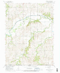
Editions of this 1965 Humboldt SW Map
2 editions found
Other maps of this area

1888 · Hiawatha
USGS Topo · 1:125,000

1889 · Seneca
USGS Topo · 1:125,000
1894 · Seneca
USGS Topo · 1:125,000

1894 · Hiawatha
USGS Topo · 1:125,000
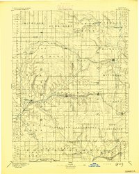
1916 · Humboldt
USGS Topo · 1:62,500

1950 · Kansas City
USGS Topo · 1:250,000

1954 · Kansas City
USGS Topo · 1:250,000

1955 · Manhattan
USGS Topo · 1:250,000

1955 · Nebraska City
USGS Topo · 1:250,000

1955 · Lincoln
USGS Topo · 1:250,000