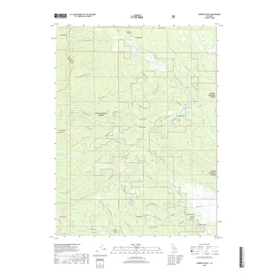
2018 Map of Humbug Valley
USGS Topo · Published 2018About this map
Lassen National Forest terrain dominates this 2018 survey, where the boundary between Plumas and Tehama counties follows the high ridgelines. The landscape is defined by an intricate network of timber and access roads, including the historic Humboldt Rd and various spurs like Soldier Mdw Spur and Grizzly Creek Spur. The presence of the Pacific Crest National Scenic Trail winding through the northwest corner highlights the area's significance for long-distance transit and recreation. Water resources are central to the geography here, with Big Springs feeding into local drainages and named meadows like Fanani Meadow providing clear markers in the high country. To the south, Little Grizzly Valley and secluded areas like Mudhole Hollow suggest a history of seasonal grazing or quiet mountain habitation away from more developed corridors.
Find a feature on this map
66 named features on this map. Tap any name to fly to it.
Don’t see what you’re looking for? This feature index may not catch every label — zoom into the map to look around manually.
Map Details
Editions of this 2018 Humbug Valley Map
This is the sole edition of this map. No revisions or reprints were ever made.
Other maps of this area

1886 · Lassen Peak
USGS Topo · 1:250,000

1892 · Lassen Peak
USGS Topo · 1:250,000

1894 · Lassen Peak
USGS Topo · 1:250,000

1955 · Almanor
USGS Topo · 1:62,500

1955 · Westwood
USGS Topo · 1:250,000

1956 · Mt. Harkness
USGS Topo · 1:62,500

1956 · Chester
USGS Topo · 1:62,500

1958 · Westwood
USGS Topo · 1:250,000

1958 · Jonesville
USGS Topo · 1:62,500

1959 · Westwood
USGS Topo · 1:250,000