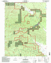
1995 Map of Humbug Valley
USGS Topo · Published 1998About this map
Lassen National Forest terrain dominates this mid-1990s survey, illustrating a landscape defined by the drainage systems of Humbug Valley and the high ridges of the Sierra Nevada. The historical Humboldt Road cuts through the territory, marking a traditional route through the mountains that predates modern highway development. The map details a complex network of water features, from the large meadow of Soldier Meadows to smaller alpine features like Mud Lake.
Find a feature on this map
30 named features on this map. Tap any name to fly to it.
Don’t see what you’re looking for? This feature index may not catch every label — zoom into the map to look around manually.
Map Details
Editions of this 1995 Humbug Valley Map
This is the sole edition of this map. No revisions or reprints were ever made.
Other maps of this area

1886 · Lassen Peak
USGS Topo · 1:250,000

1892 · Lassen Peak
USGS Topo · 1:250,000

1894 · Lassen Peak
USGS Topo · 1:250,000

1955 · Almanor
USGS Topo · 1:62,500

1955 · Westwood
USGS Topo · 1:250,000

1956 · Mt. Harkness
USGS Topo · 1:62,500

1956 · Chester
USGS Topo · 1:62,500

1958 · Westwood
USGS Topo · 1:250,000

1958 · Jonesville
USGS Topo · 1:62,500

1959 · Westwood
USGS Topo · 1:250,000