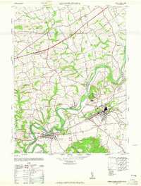
1947 Map of Hummelstown
USGS Topo · Published 1965About this map
Swatara Creek snakes through the center of this 1940s landscape, defining the industrial and recreational geography of eastern Dauphin County. The emerging footprint of Hershey is already well-established, featuring the Hershey Ind School, the Hershey Stadium, and even the Hershey Zoo. This era captures a transition in transportation as the Reading railroad and Stoverdale Station operate alongside established thoroughfares like the Benjamin Franklin Highway. To the west, the borough of Hummelstown sits at a critical junction of rail and road, while smaller hamlets such as Union Deposit and Sand Beach remain distinct rural centers. Numerous local schools, including Oak Hill School and Grubers School, are scattered across the surrounding townships, offering a clear view of the mid-century community structure before suburbanization fully connected these independent settlements.
Find a feature on this map
46 named features on this map. Tap any name to fly to it.
Don’t see what you’re looking for? This feature index may not catch every label — zoom into the map to look around manually.
Map Details
Editions of this 1947 Hummelstown Map
2 editions found
Other maps of this area

1892 · Hummelstown
USGS Topo · 1:62,500

1892 · Harrisburg
USGS Topo · 1:62,500

1899 · Harrisburg
USGS Topo · 1:62,500

1906 · New Cumberland
USGS Topo · 1:62,500

1908 · Middletown
USGS Topo · 1:62,500

1924 · Hummelstown
USGS Topo · 1:62,500

1924 · Harrisburg
USGS Topo · 1:62,500

1943 · New Cumberland
USGS Topo · 1:62,500

1943 · Middletown
USGS Topo · 1:62,500

1943 · Harrisburg
USGS Topo · 1:62,500
Featured Places
- Hershey, Derry Township
- Rutherford, Swatara Township
- Skyline View, West Hanover Township
- Hummelstown, PA
- East Hanover Township, PA