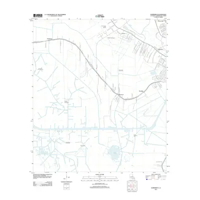
2012 Map of Humphreys
USGS Topo · Published 2012About this map
Humphreys and the surrounding coastal landscape of Terrebonne Parish are defined by an intricate network of waterways and industrial infrastructure. The settlement pattern follows the natural levees of Bayou Black and Little Bayou Black, where communities like Crescent, Waterproof, and Mandalay are linked by the Southdown Mandalay Rd. This era of the region's history is heavily influenced by the energy sector, evidenced by numerous production areas such as the Orange Grove Oil and Gas Field and the Sunrise Oil and Gas Field. To the south, the terrain transitions into the wetlands of Lake Hatch and Bayou Mauvais Bois, revealing the precarious balance between human habitation and the deltaic environment. Notable landmarks including Huffaker Field Airport and the historic Orange Grove Plantation name-site provide specific points of interest for local historians and researchers studying the evolution of land use in southern Louisiana.
Find a feature on this map
87 named features on this map. Tap any name to fly to it.
Don’t see what you’re looking for? This feature index may not catch every label — zoom into the map to look around manually.
Map Details
Editions of this 2012 Humphreys Map
This is the sole edition of this map. No revisions or reprints were ever made.
Other maps of this area

1892 · Gibson
USGS Topo · 1:62,500

1892 · Houma
USGS Topo · 1:62,500

1894 · Bayou De Large
USGS Topo · 1:62,500

1894 · Dulac
USGS Topo · 1:62,500

1897 · Gibson
USGS Topo · 1:62,500

1932 · Houma SW
USGS Topo · 1:31,680

1932 · Houma NW
USGS Topo · 1:31,680

1935 · Theriot
USGS Topo · 1:31,680

1935 · Lake Gero
USGS Topo · 1:31,680

1935 · Lake Penchant
USGS Topo · 1:31,680