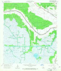
1964 Map of Humphreys
USGS Topo · Published 1965About this map
Bayou Black snakes through this low-lying landscape in Terrebonne Parish, anchoring a network of small settlements like Humphreys and Mandalay. The 1964 survey reveals an economy deeply tied to the extraction of natural resources, evidenced by the extensive Orange Grove Oil and Gas Field and Hollywood Oil and Gas Field that dominate the marshy interior. Local community life is centered along the bayou roads, where researchers can find the Bayou Black Sch, St Anthonys Ch, and St Lukes Ch.
Find a feature on this map
36 named features on this map. Tap any name to fly to it.
Don’t see what you’re looking for? This feature index may not catch every label — zoom into the map to look around manually.
Map Details
Editions of this 1964 Humphreys Map
3 editions found
Other maps of this area

1892 · Gibson
USGS Topo · 1:62,500

1892 · Houma
USGS Topo · 1:62,500

1894 · Bayou De Large
USGS Topo · 1:62,500

1894 · Dulac
USGS Topo · 1:62,500

1897 · Gibson
USGS Topo · 1:62,500

1932 · Houma SW
USGS Topo · 1:31,680

1932 · Houma NW
USGS Topo · 1:31,680

1935 · Theriot
USGS Topo · 1:31,680

1935 · Lake Gero
USGS Topo · 1:31,680

1935 · Lake Penchant
USGS Topo · 1:31,680