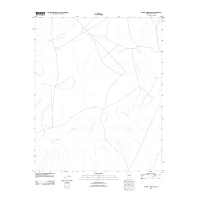
2011 Map of Humpy Camp Well
USGS Topo · Published 2011About this map
Humpy Camp Well and other vital water sources define the survival and settlement patterns of this arid landscape in Navajo County, Arizona. During this era of land management, the distribution of man-made improvements like Foster Well, New Well, and Marshall Tank indicates a region utilized for ranching or livestock grazing. The natural topography is shaped by ephemeral drainage systems such as Cottonwood Wash, Humpy Wash, and the distinctively named Fern Feather Wash. These washes dictate the local road network, which navigates around the catchment areas of Fern Feather Tank and other small reservoirs. This 2011 survey records the infrastructure required to sustain life and industry in the high desert, providing a clear picture of the isolated outposts and seasonal watercourses that characterize this portion of the American Southwest.
Find a feature on this map
8 named features on this map. Tap any name to fly to it.
Don’t see what you’re looking for? This feature index may not catch every label — zoom into the map to look around manually.
Map Details
Editions of this 2011 Humpy Camp Well Map
This is the sole edition of this map. No revisions or reprints were ever made.
Other maps of this area

1883 · Tusayan
USGS Topo · 1:250,000

1886 · Tusayan
USGS Topo · 1:250,000

1886 · Holbrook
USGS Topo · 1:250,000

1893 · Holbrook
USGS Topo · 1:250,000

1947 · Flagstaff
USGS Topo · 1:250,000

1954 · Winslow
USGS Topo · 1:62,500

1954 · Winslow 4 SE
USGS Topo · 1:24,000

1954 · Winslow 4 NE
USGS Topo · 1:24,000

1954 · Flagstaff
USGS Topo · 1:250,000

1954 · Holbrook
USGS Topo · 1:250,000