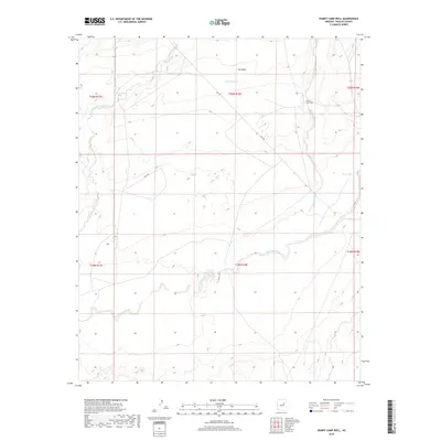
2018 Map of Humpy Camp Well
USGS Topo · Published 2018About this map
Ives Mesa stands as a prominent topographical feature in this high-desert landscape of Navajo County, which is defined by an intricate network of seasonal drainage systems. The hydrography of the region is dominated by the wandering paths of Fern-Feather Wash and the winding Cottonwood Wash, illustrating how water shaped the movement and settlement patterns in this arid territory. Man-made interventions to secure water for ranching and livestock are evident through landmarks like Humpy Camp Well, New Well, and livestock tanks such as Marshall Tank and Fern-Feather Tank. These features, connected by remote paths like the Cow Trl, reveal a landscape prioritized for cattle ranging. The map provides a clear look at the township and range survey lines that partitioned the desert, marking the intersection of natural terrain and human land management in the early twenty-first century.
Find a feature on this map
15 named features on this map. Tap any name to fly to it.
Don’t see what you’re looking for? This feature index may not catch every label — zoom into the map to look around manually.
Map Details
Editions of this 2018 Humpy Camp Well Map
This is the sole edition of this map. No revisions or reprints were ever made.
Other maps of this area

1883 · Tusayan
USGS Topo · 1:250,000

1886 · Tusayan
USGS Topo · 1:250,000

1886 · Holbrook
USGS Topo · 1:250,000

1893 · Holbrook
USGS Topo · 1:250,000

1947 · Flagstaff
USGS Topo · 1:250,000

1954 · Winslow
USGS Topo · 1:62,500

1954 · Winslow 4 SE
USGS Topo · 1:24,000

1954 · Winslow 4 NE
USGS Topo · 1:24,000

1954 · Flagstaff
USGS Topo · 1:250,000

1954 · Holbrook
USGS Topo · 1:250,000