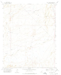
1972 Map of Humpy Camp Well
USGS Topo · Published 1975About this map
Ives Mesa dominates the northern landscape of this Navajo County region, a high ground defined by cattle tanks and infrastructure essential for desert survival. Mapped in the early 1970s, the area shows a distinct reliance on groundwater management, with a network of isolated wells such as Humpy Camp Well, Foster Well, and Cottonwood Well scattered across the arid terrain. The presence of a long Pipeline and various Jeep trails cutting through the wash systems suggests an active, managed range.
Find a feature on this map
16 named features on this map. Tap any name to fly to it.
Don’t see what you’re looking for? This feature index may not catch every label — zoom into the map to look around manually.
Map Details
Editions of this 1972 Humpy Camp Well Map
This is the sole edition of this map. No revisions or reprints were ever made.
Other maps of this area

1883 · Tusayan
USGS Topo · 1:250,000

1886 · Tusayan
USGS Topo · 1:250,000

1886 · Holbrook
USGS Topo · 1:250,000

1893 · Holbrook
USGS Topo · 1:250,000

1947 · Flagstaff
USGS Topo · 1:250,000

1954 · Winslow
USGS Topo · 1:62,500

1954 · Winslow 4 SE
USGS Topo · 1:24,000

1954 · Winslow 4 NE
USGS Topo · 1:24,000

1954 · Flagstaff
USGS Topo · 1:250,000

1954 · Holbrook
USGS Topo · 1:250,000