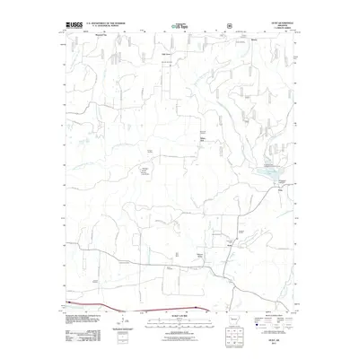
2011 Map of Hunt
USGS Topo · Published 2011About this map
Hunt serves as a central point of this modern topographic record, characterized by a mix of forestry, mining, and rural homesteads in the Ozark foothills. The local landscape is defined by the drainage systems of Horsehead Creek and Dirty Creek, with the large Horsehead Lake providing a significant water resource managed by the Horsehead Lake Dam. Evidence of local industry and resource extraction is found at the Utah Strip Mine in Philpott Valley, contrasting with the quietude of numerous family and community burial grounds such as Hailey Cemetery and Harmon Cemetery.
Find a feature on this map
64 named features on this map. Tap any name to fly to it.
Don’t see what you’re looking for? This feature index may not catch every label — zoom into the map to look around manually.
Map Details
Editions of this 2011 Hunt Map
This is the sole edition of this map. No revisions or reprints were ever made.
Other maps of this area

1879 · Cravens
USGS Topo · 1:62,500

1887 · Magazine Mountain #1
USGS Topo · 1:62,500

1887 · Magazine Mountain #2
USGS Topo · 1:62,500

1887 · Watalula
USGS Topo · 1:62,500

1887 · Magazine Mountain
USGS Topo · 1:62,500

1890 · Magazine Mountain
USGS Topo · 1:125,000

1906 · Batson
USGS Topo · 1:62,500

1939 · Watalula
USGS Topo · 1:62,500

1956 · Russellville
USGS Topo · 1:250,000

1961 · Coal Hill
USGS Topo · 1:24,000