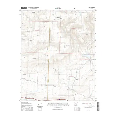
2014 Map of Hunt
USGS Topo · Published 2014About this map
The boundary between Franklin Co and Johnson Co bisects this portion of the Ozark National Forest, a landscape defined by elevated ridges and deep creek valleys. In the southern reach, Wiederkehr Village sits near the winding course of McKinney Cr, while the settlement of Hunt is positioned near the confluence of Dirty Cr and Horsehead Cr. The map reveals a dense network of family and community history through its numerous burial grounds, including Hardgraves Cem, Green Cem, and Harmon Cem.
Find a feature on this map
80 named features on this map. Tap any name to fly to it.
Don’t see what you’re looking for? This feature index may not catch every label — zoom into the map to look around manually.
Map Details
Editions of this 2014 Hunt Map
This is the sole edition of this map. No revisions or reprints were ever made.
Other maps of this area

1879 · Cravens
USGS Topo · 1:62,500

1887 · Magazine Mountain #1
USGS Topo · 1:62,500

1887 · Magazine Mountain #2
USGS Topo · 1:62,500

1887 · Watalula
USGS Topo · 1:62,500

1887 · Magazine Mountain
USGS Topo · 1:62,500

1890 · Magazine Mountain
USGS Topo · 1:125,000

1906 · Batson
USGS Topo · 1:62,500

1939 · Watalula
USGS Topo · 1:62,500

1956 · Russellville
USGS Topo · 1:250,000

1961 · Coal Hill
USGS Topo · 1:24,000